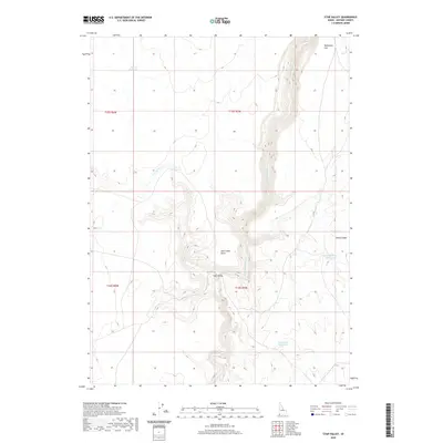
2020 Map of Star Valley
USGS Topo · Published 2020About this map
Little Owyhee River carves a deep, sinuous path through this high desert plateau in Owyhee County. The landscape is defined by its drainage systems and strategic water management, with numerous catchments like Sorrel Reservoir and Sundown Reservoir supporting the arid terrain. The map reveals a topography of sharp elevation changes at Tent Creek Point, where the land drops away into the namesake Star Valley. This region, characterized by open flats such as Halogeton Flat and deep basins like Walcot Basin, demonstrates the isolation of the Idaho high country. Small waterways, including Tent Cr and its associated Tent Cr Reservoir, feed into the larger river system, illustrating how water availability dictated land use in this remote ranching and grazing territory.
Find a feature on this map
14 named features on this map. Tap any name to fly to it.
Don’t see what you’re looking for? This feature index may not catch every label — zoom into the map to look around manually.
Map Details
Editions of this 2020 Star Valley Map
This is the sole edition of this map. No revisions or reprints were ever made.
Other maps of this area

1882 · Paradise
USGS Topo · 1:250,000

1893 · Paradise
USGS Topo · 1:250,000

1955 · McDermitt
USGS Topo · 1:250,000

1955 · Jordan Valley
USGS Topo · 1:250,000

1957 · Jordan Valley
USGS Topo · 1:250,000

1958 · Jordan Valley
USGS Topo · 1:250,000

1959 · McDermitt
USGS Topo · 1:250,000

1973 · Coyote Hole
USGS Topo · 1:24,000

1973 · Grassy Ridge
USGS Topo · 1:24,000

1973 · Spring Creek Basin
USGS Topo · 1:24,000