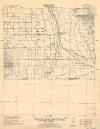
1932 Map of Stark
USGS Topo · Published 1932About this map
The San Rafael Del Valle land grant area along the San Pedro River defines this 1932 tactical survey, capturing the borderlands of Cochise County during a period of transition. The river valley serves as a corridor for the Southern Pacific railroad and the Bisbee Borderland Road Route, which connect small settlements and cattle operations like Hereford and the Canton Ranch. Evidence of groundwater reliance is visible through the Artesian Wells located north of Palominas School.
Find a feature on this map
34 named features on this map. Tap any name to fly to it.
Don’t see what you’re looking for? This feature index may not catch every label — zoom into the map to look around manually.
Map Details
Editions of this 1932 Stark Map
This is the sole edition of this map. No revisions or reprints were ever made.
Other maps of this area
1902 · Bisbee
USGS Topo · 1:62,500
1910 · Bisbee
USGS Topo · 1:62,500
1914 · Hereford
USGS Topo · 1:125,000
1915 · Benson
USGS Topo · 1:125,000
1916 · Pearce
USGS Topo · 1:125,000
1916 · Douglas
USGS Topo · 1:125,000
1919 · Douglas
USGS Topo · 1:125,000
1922 · Sunnyside
USGS Topo · 1:62,500
1925 · Gleeson
USGS Topo · 1:62,500
1927 · Bisbee
USGS Topo · 1:62,500