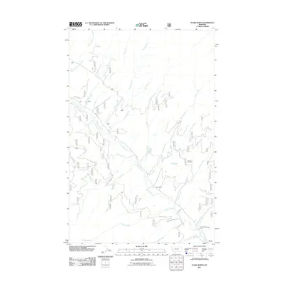
2011 Map of Stark North
USGS Topo · Published 2011About this map
Ninemile Creek and its many tributaries define the rugged geography of this mountain landscape northwest of Missoula. The settlement of Stark anchors the southeastern corner, serving as a gateway to the complex network of forest roads and drainages that shaped the local timber and mining economy. Traces of industrial history are etched into the terrain, most notably at the Josephine Creek Mine and the Ninemile/McCormick Mine, which sit near the steep ridges above Josephine Creek and McCormick Creek.
Find a feature on this map
28 named features on this map. Tap any name to fly to it.
Don’t see what you’re looking for? This feature index may not catch every label — zoom into the map to look around manually.
Map Details
Editions of this 2011 Stark North Map
This is the sole edition of this map. No revisions or reprints were ever made.
Other maps of this area

1956 · Wallace
USGS Topo · 1:250,000

1959 · Tarkio
USGS Topo · 1:62,500

1959 · Alberton
USGS Topo · 1:62,500

1959 · Perma
USGS Topo · 1:62,500

1960 · Wallace
USGS Topo · 1:250,000

1964 · Mc Donald
USGS Topo · 1:24,000

1983 · Horsehead Peak
USGS Topo · 1:24,000
1983 · Tarkio
USGS Topo · 1:24,000
1983 · Stark South
USGS Topo · 1:24,000

1984 · Stark North
USGS Topo · 1:24,000