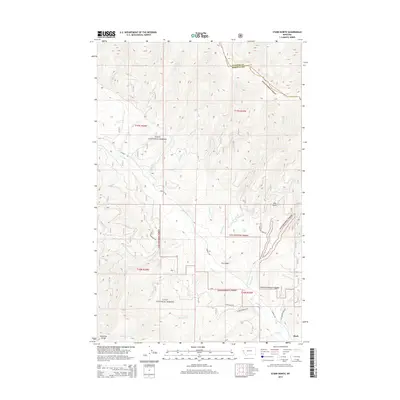
2014 Map of Stark North
USGS Topo · Published 2014About this map
The mountain-shadowed drainage of Ninemile Cr defines this 2014 survey of the Lolo National Forest, situated along the border of Sanders and Missoula Counties. The settlement of Stark occupies the southeastern corner of the quadrangle, serving as a focal point near the convergence of McCormick Cr and Fire Cr. High-elevation landmarks such as Ninemile Divide and the secluded Lost Lake characterize the steep, wooded terrain. A network of forest and local access roads, including W Side Ninemile Rd and Josephine Creek Rd, traces the contours of the landscape, providing access to remote drainages like Moncure Cr and Barrette Cr. This modern topographic study documents the complex system of forest service routes and watercourses that shape the northern reaches of the Ninemile valley.
Find a feature on this map
33 named features on this map. Tap any name to fly to it.
Don’t see what you’re looking for? This feature index may not catch every label — zoom into the map to look around manually.
Map Details
Editions of this 2014 Stark North Map
This is the sole edition of this map. No revisions or reprints were ever made.
Other maps of this area

1956 · Wallace
USGS Topo · 1:250,000

1959 · Tarkio
USGS Topo · 1:62,500

1959 · Alberton
USGS Topo · 1:62,500

1959 · Perma
USGS Topo · 1:62,500

1960 · Wallace
USGS Topo · 1:250,000

1964 · Mc Donald
USGS Topo · 1:24,000

1983 · Horsehead Peak
USGS Topo · 1:24,000
1983 · Tarkio
USGS Topo · 1:24,000
1983 · Stark South
USGS Topo · 1:24,000

1984 · Stark North
USGS Topo · 1:24,000