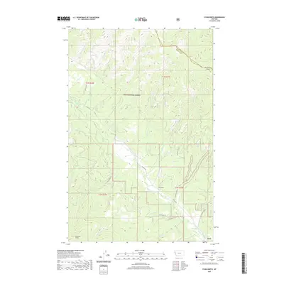
2020 Map of Stark North
USGS Topo · Published 2020About this map
Lolo National Forest dominates this mountainous landscape in Missoula County, where the settlement of Stark sits at the southern edge near the confluence of major drainages. The area is defined by its complex hydrology, with Ninemile Cr serving as a central artery for numerous tributaries such as Marion Cr, Josephine Cr, and Moncure Cr. These waterways cut through the high ridges of the Reservation Divide to the north and the Ninemile Divide to the south.
Find a feature on this map
34 named features on this map. Tap any name to fly to it.
Don’t see what you’re looking for? This feature index may not catch every label — zoom into the map to look around manually.
Map Details
Editions of this 2020 Stark North Map
This is the sole edition of this map. No revisions or reprints were ever made.
Other maps of this area

1956 · Wallace
USGS Topo · 1:250,000

1959 · Tarkio
USGS Topo · 1:62,500

1959 · Alberton
USGS Topo · 1:62,500

1959 · Perma
USGS Topo · 1:62,500

1960 · Wallace
USGS Topo · 1:250,000

1964 · Mc Donald
USGS Topo · 1:24,000

1983 · Horsehead Peak
USGS Topo · 1:24,000
1983 · Tarkio
USGS Topo · 1:24,000
1983 · Stark South
USGS Topo · 1:24,000

1984 · Stark North
USGS Topo · 1:24,000