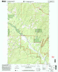
1999 Map of Stark North
USGS Topo · Published 2003About this map
Flathead Indian Reservation lands meet the northern boundary of this western Montana landscape, where the Lolo National Forest encompasses much of the drainages flowing toward Stark. The terrain is defined by the significant hydrological network of Ninemile Creek and its many tributaries, including Dry Josephine Creek and McCormick Creek. Small-scale resource extraction is evident near the center of the sheet, where a Mine and Gravel Pit are located south of the Fourth Standard Parallel North. The presence of a solitary Corral near the southern bend of Ninemile Creek suggests the persistent role of livestock management within the forest boundaries. Further south, Barrette Creek and Moncure Creek cut through the lower elevations, illustrating the complex watershed patterns of the Missoula County and Sanders County border region.
Find a feature on this map
26 named features on this map. Tap any name to fly to it.
Don’t see what you’re looking for? This feature index may not catch every label — zoom into the map to look around manually.
Map Details
Editions of this 1999 Stark North Map
This is the sole edition of this map. No revisions or reprints were ever made.
Other maps of this area

1956 · Wallace
USGS Topo · 1:250,000

1959 · Tarkio
USGS Topo · 1:62,500

1959 · Alberton
USGS Topo · 1:62,500

1959 · Perma
USGS Topo · 1:62,500

1960 · Wallace
USGS Topo · 1:250,000

1964 · Mc Donald
USGS Topo · 1:24,000

1983 · Horsehead Peak
USGS Topo · 1:24,000
1983 · Tarkio
USGS Topo · 1:24,000
1983 · Stark South
USGS Topo · 1:24,000

1984 · Stark North
USGS Topo · 1:24,000