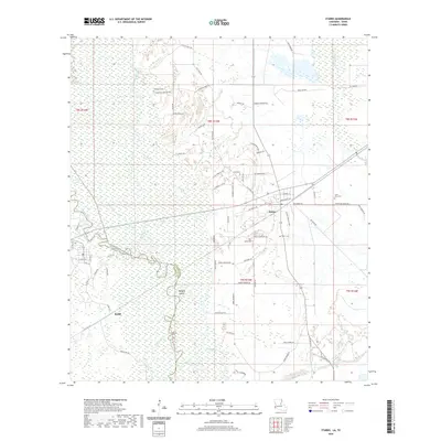
2020 Map of Starks
USGS Topo · Published 2020About this map
The Sabine River forms a jagged natural boundary between Louisiana and Texas, creating a complex wetland environment of bayous and sloughs. On the Texas side, the settlement of Ruliff sits near the riverbanks, while Starks serves as a hub in Louisiana, connected by the Kansas City Southern railroad. The landscape is defined by its drainage patterns, with Beckwith Creek and Old River winding through the terrain alongside numerous named water features like Ashworth Slough and Indian Bayou.
Find a feature on this map
84 named features on this map. Tap any name to fly to it.
Don’t see what you’re looking for? This feature index may not catch every label — zoom into the map to look around manually.
Map Details
Editions of this 2020 Starks Map
This is the sole edition of this map. No revisions or reprints were ever made.
Other maps of this area

1926 · Mauriceville
USGS Topo · 1:24,000

1932 · Orange
USGS Topo · 1:62,500

1943 · Mauriceville
USGS Topo · 1:24,000

1947 · Starks
USGS Topo · 1:31,680

1947 · Vinton
USGS Topo · 1:31,680

1947 · Toomey
USGS Topo · 1:31,680

1947 · Carter Creek
USGS Topo · 1:31,680

1947 · Lunita
USGS Topo · 1:31,680

1947 · Long Marsh
USGS Topo · 1:31,680

1952 · Lake Charles
USGS Topo · 1:250,000