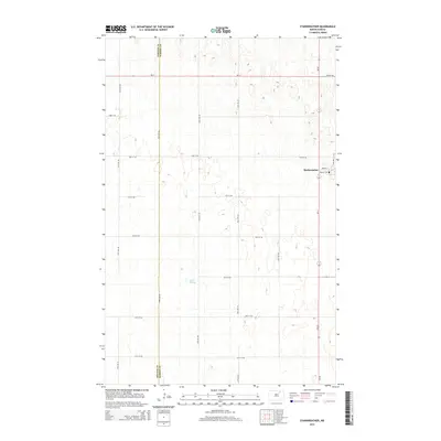
2014 Map of Starkweather
USGS Topo · Published 2014About this map
Starkweather serves as the primary focal point of this North Dakota landscape, situated at the crossroads of ND-17 and ND-20. The town's grid is clearly defined by local thoroughfares such as Main St and Martin St, featuring the local Po as a central landmark. This 2014 survey documents a region characterized by a high concentration of prairie potholes and wetlands, most notably the expansive Davis Slough which dominates the central portion of the map. The terrain is divided by a series of precisely spaced section line roads, including 72nd St NE and 80th Ave NE, illustrating the persistent influence of the Public Land Survey System on the modern agricultural landscape. The northwestern corner of the quadrangle marks the political boundary at the Towner Co Ramsey Co line, where the prairie continues its undulating pattern of depressions and low rises.
Find a feature on this map
22 named features on this map. Tap any name to fly to it.
Don’t see what you’re looking for? This feature index may not catch every label — zoom into the map to look around manually.
Map Details
Editions of this 2014 Starkweather Map
This is the sole edition of this map. No revisions or reprints were ever made.
Other maps of this area

1953 · Devils Lake
USGS Topo · 1:250,000

1956 · Devils Lake
USGS Topo · 1:250,000

1957 · Cando SE
USGS Topo · 1:24,000

1957 · Starkweather SE
USGS Topo · 1:24,000

1957 · Cando NE
USGS Topo · 1:24,000

1957 · Webster
USGS Topo · 1:24,000

1962 · Egeland SE
USGS Topo · 1:24,000

1962 · Starkweather
USGS Topo · 1:24,000

1962 · Starkweather NE
USGS Topo · 1:24,000

1971 · Munich SW
USGS Topo · 1:24,000