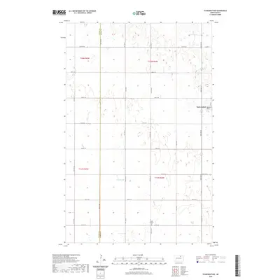
2020 Map of Starkweather
USGS Topo · Published 2020About this map
Starkweather serves as the central hub of this agricultural landscape in Ramsey County, situated at the intersection of Main St and 5th Ave. The surrounding terrain is defined by a dense network of sectional roads, including Co Hwy 9, that navigate a series of prairie potholes and wetlands typical of the North Dakota plains. The presence of Davis Slough west of the township illustrates the local hydrology, where seasonal water bodies dot the township lines. To the south, the Bergen Lutheran Cem along 80th Ave NE provides a significant touchstone for genealogical research, marking the heritage of the early Lutheran congregations that settled this portion of the northern plains. The map also traces the boundary between Towner Co and Ramsey Co, reflecting the administrative divisions of these rural communities.
Find a feature on this map
25 named features on this map. Tap any name to fly to it.
Don’t see what you’re looking for? This feature index may not catch every label — zoom into the map to look around manually.
Map Details
Editions of this 2020 Starkweather Map
This is the sole edition of this map. No revisions or reprints were ever made.
Other maps of this area

1953 · Devils Lake
USGS Topo · 1:250,000

1956 · Devils Lake
USGS Topo · 1:250,000

1957 · Cando SE
USGS Topo · 1:24,000

1957 · Starkweather SE
USGS Topo · 1:24,000

1957 · Cando NE
USGS Topo · 1:24,000

1957 · Webster
USGS Topo · 1:24,000

1962 · Egeland SE
USGS Topo · 1:24,000

1962 · Starkweather
USGS Topo · 1:24,000

1962 · Starkweather NE
USGS Topo · 1:24,000

1971 · Munich SW
USGS Topo · 1:24,000