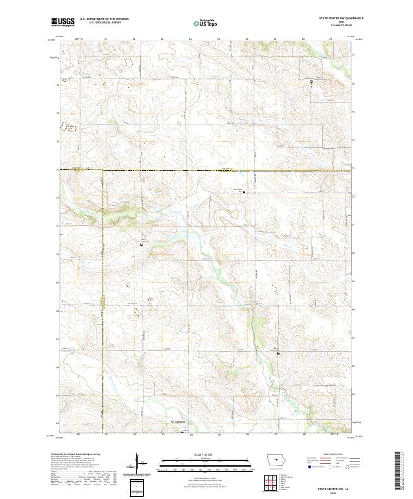
2022 Map of State Center NW
USGS Topo · Published 2022About this map
St. Anthony sits at the southern edge of this Central Iowa landscape, where the headwaters of several drainages carve a rolling pattern through the agricultural grid. The map reveals a high concentration of pioneer-era burial grounds, including Illinois Grove Cem and Bevins Grove Cem, which often mark the sites of early rural communities or church congregations that predated modern township consolidation.
Find a feature on this map
33 named features on this map. Tap any name to fly to it.
Don’t see what you’re looking for? This feature index may not catch every label — zoom into the map to look around manually.
Map Details
Editions of this 2022 State Center NW Map
This is the sole edition of this map. No revisions or reprints were ever made.
Other maps of this area

1954 · Waterloo
USGS Topo · 1:250,000

1955 · Waterloo
USGS Topo · 1:250,000

1975 · State Center NW
USGS Topo · 1:24,000

1975 · State Center
USGS Topo · 1:24,000

1975 · Union
USGS Topo · 1:24,000

1975 · Zearing
USGS Topo · 1:24,000
1975 · La Moille
USGS Topo · 1:24,000
1975 · Colo
USGS Topo · 1:24,000

1979 · New Providence
USGS Topo · 1:24,000

1979 · Hubbard
USGS Topo · 1:24,000