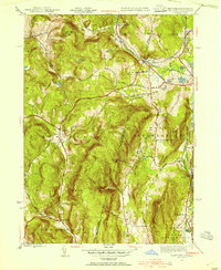
1944 Map of State Line
USGS Topo · Published 1954About this map
Richmond Furnace and the village of State Line serve as focal points for this 1944 survey of the borderlands between New York and Massachusetts. The region is defined by a series of prominent peaks, including Harvey Mtn, Fog Hill, and Bald Mtn, which separate the drainage of the Indian Brook and Flat Brook. This era shows a landscape where industrial heritage meets rural life, evidenced by the presence of Richmond Furnace and local educational institutions like Red Rock Sch and Fog Hill Sch.
Find a feature on this map
61 named features on this map. Tap any name to fly to it.
Don’t see what you’re looking for? This feature index may not catch every label — zoom into the map to look around manually.
Map Details
Editions of this 1944 State Line Map
3 editions found
Other maps of this area

1885 · Sheffield
USGS Topo · 1:62,500

1888 · Sheffield
USGS Topo · 1:62,500

1888 · Pittsfield
USGS Topo · 1:62,500

1890 · Pittsfield
USGS Topo · 1:62,500

1891 · Sheffield
USGS Topo · 1:62,500

1893 · Sheffield
USGS Topo · 1:62,500

1893 · Pittsfield
USGS Topo · 1:62,500

1894 · Pittsfield
USGS Topo · 1:62,500

1897 · Pittsfield
USGS Topo · 1:62,500

1897 · Sheffield
USGS Topo · 1:62,500