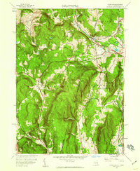
1944 Map of State Line
USGS Topo · Published 1959About this map
The New York Massachusetts state line cuts through this high-elevation terrain, where the Berkshires meet the Taconic Mountains. In the mid-1940s, the industrial legacy of the region is still visible at Richmond Furnace and Williamsville, while the Boston and Albany railroad navigates the steep grades near State Line. Educational outposts like Red Rock Sch and Fog Hill Sch serve isolated rural pockets amidst a landscape of prominent peaks, including Harvey Mtn and Tom Ball Mtn. The transport network is defined by early crossings such as Austerlitz Rd. and West Stockbridge Rd., providing a detailed view of the corridor between Columbia County and Berkshire County before the full impact of mid-century highway expansion.
Find a feature on this map
53 named features on this map. Tap any name to fly to it.
Don’t see what you’re looking for? This feature index may not catch every label — zoom into the map to look around manually.
Map Details
Editions of this 1944 State Line Map
3 editions found
Other maps of this area

1885 · Sheffield
USGS Topo · 1:62,500

1888 · Sheffield
USGS Topo · 1:62,500

1888 · Pittsfield
USGS Topo · 1:62,500

1890 · Pittsfield
USGS Topo · 1:62,500

1891 · Sheffield
USGS Topo · 1:62,500

1893 · Sheffield
USGS Topo · 1:62,500

1893 · Pittsfield
USGS Topo · 1:62,500

1894 · Pittsfield
USGS Topo · 1:62,500

1897 · Pittsfield
USGS Topo · 1:62,500

1897 · Sheffield
USGS Topo · 1:62,500