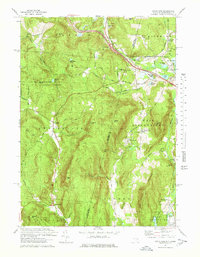
1973 Map of State Line
USGS Topo · Published 1978About this map
Richmond Furnace and the interstate borderlands of New York and Massachusetts define this landscape in the early 1970s. The region is marked by industrial remnants and early settlement patterns, where the Penn Central tracks and the Massachusetts Toll Road intersect the quiet terrain near State Line. Iron ore processing has left its mark on the geography through features like Hudson Ore Bed Pond and Leet Ore Bed Pond, while small communities like West Stockbridge Center and Austerlitz maintain their historic character. To the west, the wooded slopes of Beebe Hill State Forest rise above Beebe Pond, anchored by a Lookout Tower on Beebe Hill. This survey captures the transition from a nineteenth-century mining and milling economy toward a landscape of reforestation and modern transit, preserved just as the rural character of the Berkshire and Columbia county lines remained clearly visible.
Find a feature on this map
64 named features on this map. Tap any name to fly to it.
Don’t see what you’re looking for? This feature index may not catch every label — zoom into the map to look around manually.
Map Details
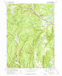
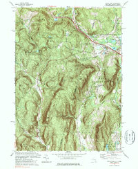
Editions of this 1973 State Line Map
3 editions found
Other maps of this area

1885 · Sheffield
USGS Topo · 1:62,500

1888 · Sheffield
USGS Topo · 1:62,500

1888 · Pittsfield
USGS Topo · 1:62,500

1890 · Pittsfield
USGS Topo · 1:62,500

1891 · Sheffield
USGS Topo · 1:62,500

1893 · Sheffield
USGS Topo · 1:62,500

1893 · Pittsfield
USGS Topo · 1:62,500

1894 · Pittsfield
USGS Topo · 1:62,500

1897 · Pittsfield
USGS Topo · 1:62,500

1897 · Sheffield
USGS Topo · 1:62,500