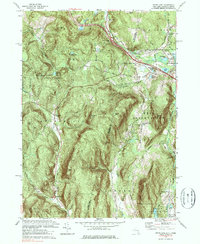
1973 Map of State Line
USGS Topo · Published 1985About this map
Richmond Furnace and the industrial remnants of the Berkshire region anchor the northern edge of this study along the border of New York and Massachusetts. The landscape is defined by the high ridges of Tom Ball Mountain and Harvey Mtn, which separate the drainage of the Green River from the Williams River. Evidence of the area's mining history is preserved in the Hudson Ore Bed Ponds and Lee Ore Bed Pond, while the transit corridor of the Penn Central railroad and the New York Thruway cut through the narrow pass at State Line.
Find a feature on this map
55 named features on this map. Tap any name to fly to it.
Don’t see what you’re looking for? This feature index may not catch every label — zoom into the map to look around manually.
Map Details
Editions of this 1973 State Line Map
3 editions found
Other maps of this area

1885 · Sheffield
USGS Topo · 1:62,500

1888 · Sheffield
USGS Topo · 1:62,500

1888 · Pittsfield
USGS Topo · 1:62,500

1890 · Pittsfield
USGS Topo · 1:62,500

1891 · Sheffield
USGS Topo · 1:62,500

1893 · Sheffield
USGS Topo · 1:62,500

1893 · Pittsfield
USGS Topo · 1:62,500

1894 · Pittsfield
USGS Topo · 1:62,500

1897 · Pittsfield
USGS Topo · 1:62,500

1897 · Sheffield
USGS Topo · 1:62,500