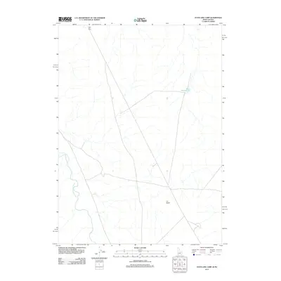
2012 Map of State Line Camp
USGS Topo · Published 2012About this map
State Line Camp sits on the high plateau of the Nevada-Idaho border, a site defined by its isolation and the drainage patterns of the high desert. This 2012 survey captures a transition point where the Y P Desert meets the winding course of the South Fork Owyhee River. The landscape is sparse, marked primarily by ranching infrastructure and the seasonal water management represented by Garat Reservoir G9. Transportation across this borderland relies on a network of unpaved local roads and 4WD tracks, reflecting the enduring remote character of Elko County. The map provides a precise look at the drainage networks and topography that have long dictated human activity and settlement patterns in this arid region of the Great Basin.
Find a feature on this map
4 named features on this map. Tap any name to fly to it.
Don’t see what you’re looking for? This feature index may not catch every label — zoom into the map to look around manually.
Map Details
Editions of this 2012 State Line Camp Map
This is the sole edition of this map. No revisions or reprints were ever made.
Other maps of this area

1955 · McDermitt
USGS Topo · 1:250,000

1955 · Jordan Valley
USGS Topo · 1:250,000

1957 · Jordan Valley
USGS Topo · 1:250,000

1958 · Jordan Valley
USGS Topo · 1:250,000

1959 · McDermitt
USGS Topo · 1:250,000

1964 · Hat Peak
USGS Topo · 1:62,500

1971 · Juniper Basin
USGS Topo · 1:24,000

1973 · Bull Camp Butte
USGS Topo · 1:24,000
1973 · Rubber Hill
USGS Topo · 1:24,000

1973 · Twelvemile Flat
USGS Topo · 1:24,000