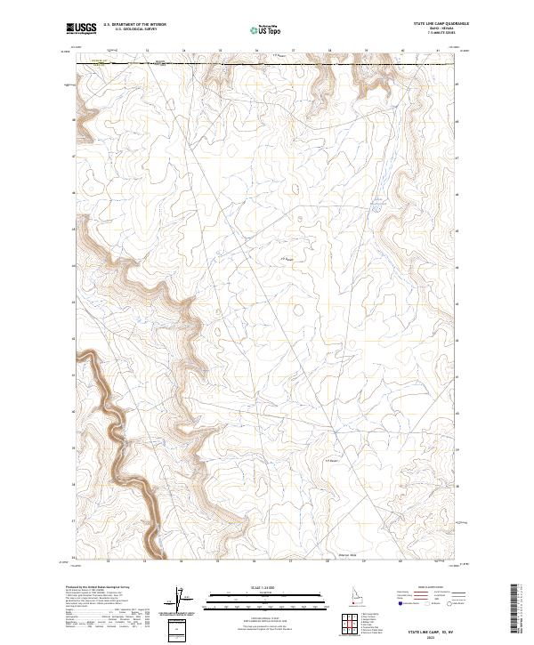
2023 Map of State Line Camp
USGS Topo · Published 2023About this map
The South Fork Owyhee River carves a significant course through this high-desert region where the borders of Owyhee County, Idaho, and Elko County, Nevada, converge. This area is defined by the expansive Y P Desert, a landscape of subtle elevation shifts and remote plateaus like Peterson Table. The presence of the Garat Reservoir G9 in the northeast suggests the critical role of water management in this arid environment, supporting the grazing lands that characterize the interstate boundary region. The mapping highlights the intersection of state lines and the complex township and range system, including t16s r2w and t47n r49e, which provide the structural framework for land use and ranching history in this corner of the Great Basin.
Find a feature on this map
13 named features on this map. Tap any name to fly to it.
Don’t see what you’re looking for? This feature index may not catch every label — zoom into the map to look around manually.
Map Details
Editions of this 2023 State Line Camp Map
This is the sole edition of this map. No revisions or reprints were ever made.
Other maps of this area

1955 · McDermitt
USGS Topo · 1:250,000

1955 · Jordan Valley
USGS Topo · 1:250,000

1957 · Jordan Valley
USGS Topo · 1:250,000

1958 · Jordan Valley
USGS Topo · 1:250,000

1959 · McDermitt
USGS Topo · 1:250,000

1964 · Hat Peak
USGS Topo · 1:62,500

1971 · Juniper Basin
USGS Topo · 1:24,000

1973 · Bull Camp Butte
USGS Topo · 1:24,000
1973 · Rubber Hill
USGS Topo · 1:24,000

1973 · Twelvemile Flat
USGS Topo · 1:24,000