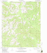
1982 Map of State Line
USGS Topo · Published 1982About this map
The Mississippi Louisiana border defines the character of this 1982 survey, where Walthall Co and Washington Parish meet. The landscape is dominated by the sprawling Dean Lee State Forest in the southwest and a dense network of watercourses including Pushepatapa Creek and Bogue Lusa Creek. For the genealogist, the map is remarkably dense with family-named landmarks and cemeteries, such as the Kennedy Cem, Schillings Cem, Pierce Cem, and Adams Cem.
Find a feature on this map
49 named features on this map. Tap any name to fly to it.
Don’t see what you’re looking for? This feature index may not catch every label — zoom into the map to look around manually.
Map Details
Editions of this 1982 State Line Map
This is the sole edition of this map. No revisions or reprints were ever made.
Other maps of this area

1942 · Thigpen
USGS Topo · 1:31,680

1942 · Thomas
USGS Topo · 1:31,680

1949 · Bogalusa East
USGS Topo · 1:31,680

1949 · Angie
USGS Topo · 1:31,680

1949 · Bogalusa West
USGS Topo · 1:31,680

1950 · Crains Creek
USGS Topo · 1:31,680

1953 · Hattiesburg
USGS Topo · 1:250,000

1953 · Natchez
USGS Topo · 1:250,000

1953 · Mobile
USGS Topo · 1:250,000

1954 · Baton Rouge
USGS Topo · 1:250,000