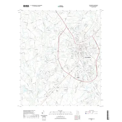
2020 Map of Statesboro
USGS Topo · Published 2020About this map
The city of Statesboro serves as the focal point of this coastal plain landscape, characterized by its radial road network and the significant presence of Georgia Southern University. The town's civic heart is anchored by the Bulloch County Courthouse, while its growth is evidenced by the modern bypass system encircling the central district. Outside the urban core, the terrain is defined by a dense network of water bodies, including Mallard Pond, Lake Ruby, and Lake Wells, which integrate with the residential and collegiate infrastructure.
Find a feature on this map
258 named features on this map. Tap any name to fly to it.
Don’t see what you’re looking for? This feature index may not catch every label — zoom into the map to look around manually.
Map Details
Editions of this 2020 Statesboro Map
This is the sole edition of this map. No revisions or reprints were ever made.
Other maps of this area

1918 · Oliver
USGS Topo · 1:62,500

1920 · Statesboro
USGS Topo · 1:62,500

1920 · Oliver
USGS Topo · 1:62,500

1921 · Brooklet
USGS Topo · 1:62,500

1921 · Rocky Ford
USGS Topo · 1:62,500

1943 · Brooklet
USGS Topo · 1:62,500

1943 · Rocky Ford
USGS Topo · 1:62,500

1943 · Millen
USGS Topo · 1:125,000

1943 · Statesboro
USGS Topo · 1:62,500

1943 · Oliver
USGS Topo · 1:62,500