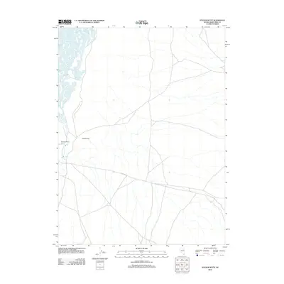
2012 Map of Station Butte
USGS Topo · Published 2012About this map
Station Butte rises as a central landmark in this high-desert region of White Pine County, where a network of trails and roads converges in a landscape shaped by intermittent water and ranching history. The presence of the Fort Ruby Ranch Airstrip highlights the specialized infrastructure required for remote Nevada ranching operations, while Woodwards Creek and Station Spring indicate the critical water sources that dictate movement through this arid basin. Running east-to-west, Overland Rd reflects a long-standing corridor of travel across the Great Basin, connecting this isolated segment of the county to wider transit routes.
Find a feature on this map
5 named features on this map. Tap any name to fly to it.
Don’t see what you’re looking for? This feature index may not catch every label — zoom into the map to look around manually.
Map Details
Editions of this 2012 Station Butte Map
This is the sole edition of this map. No revisions or reprints were ever made.
Other maps of this area

1934 · Jiggs
USGS Topo · 1:125,000

1937 · Jiggs
USGS Topo · 1:125,000

1955 · Elko
USGS Topo · 1:250,000

1956 · Ely
USGS Topo · 1:250,000

1957 · Cold Creek Ranch
USGS Topo · 1:62,500

1958 · Elko
USGS Topo · 1:250,000

1959 · Ely
USGS Topo · 1:250,000

1959 · Sherman Mtn
USGS Topo · 1:62,500

1962 · Elko
USGS Topo · 1:250,000

1963 · Ely
USGS Topo · 1:250,000