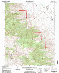
1994 Map of Station Peak
USGS Topo · Published 1997About this map
Station Peak 10316 dominates the high-elevation landscape of the Inyo National Forest along the border of Mono County and Nevada's Esmeralda County. The map documents the intricate drainage systems carved by Cottonwood Creek, Furnace Creek, and Wildhorse Creek, which flow from the alpine heights toward the arid Fish Lake Valley. A notable cartographic detail is the presence of the Von Schmidt Line, representing the original 1872 surveying effort to define the boundary between California and Nevada. Historical survey markers, including State Mon No 88 and State Mon No 89, anchor this line through the desert floor. To the north, Red Mountain stands near several remote Prospect locations, while a lone Landing Strip and a Borrow Pit in the valley indicate the sparse human infrastructure and small-scale resource extraction typical of the eastern Sierra Nevada rain shadow in the mid-1990s.
Find a feature on this map
20 named features on this map. Tap any name to fly to it.
Don’t see what you’re looking for? This feature index may not catch every label — zoom into the map to look around manually.
Map Details
Editions of this 1994 Station Peak Map
This is the sole edition of this map. No revisions or reprints were ever made.
Other maps of this area

1898 · Silver Peak
USGS Topo · 1:125,000

1900 · Silver Peak
USGS Topo · 1:125,000

1908 · Lida
USGS Topo · 1:250,000

1913 · Bishop
USGS Topo · 1:125,000

1913 · Lida
USGS Topo · 1:250,000

1917 · White Mountain
USGS Topo · 1:125,000

1947 · Mariposa
USGS Topo · 1:250,000

1948 · Mariposa
USGS Topo · 1:250,000

1951 · Blanco Mountain
USGS Topo · 1:62,500

1954 · Goldfield
USGS Topo · 1:250,000