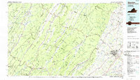
1986 Map of Staunton
USGS Topo · Published 1986About this map
Staunton serves as the eastern anchor of this mid-1980s map, where the city's institutional history is marked by Mary Baldwin College and the Virginia School for the Deaf and Blind. The landscape is defined by the high ridges of Shenandoah Mountain and Great North Mountain, creating a natural barrier that funnelled early migration and transport along the valleys. Small highland settlements like Monterey and McDowell remain distinct within the George Washington National Forest, while the western edge reaches into West Virginia toward Green Bank and the Cass Scenic Railroad State Park. The region's thermal springs economy is evident in Warm Springs and Hot Springs, connected by the winding path of State Route 220. Deep rail heritage is visible in the routes of the Chesapeake and Ohio Railroad and the Norfolk and Western Railroad, which follow the river gaps and limestone valleys of Augusta County.
Find a feature on this map
318 named features on this map. Tap any name to fly to it.
Don’t see what you’re looking for? This feature index may not catch every label — zoom into the map to look around manually.
Map Details
Editions of this 1986 Staunton Map
2 editions found
Other maps of this area

1887 · Lewisburg
USGS Topo · 1:125,000

1889 · Beverly
USGS Topo · 1:125,000

1891 · Lewisburg
USGS Topo · 1:125,000

1891 · Huntersville
USGS Topo · 1:125,000

1892 · Beverly
USGS Topo · 1:125,000

1892 · Buckingham
USGS Topo · 1:125,000

1892 · Franklin
USGS Topo · 1:125,000

1892 · Woodstock
USGS Topo · 1:125,000

1892 · Harrisonburg
USGS Topo · 1:125,000

1893 · Buckhannon
USGS Topo · 1:125,000