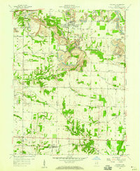
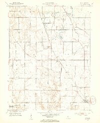
1958 Map of Staunton
USGS Topo · Published 1959About this map
Clay County's industrial and agricultural landscape is captured here just as the post-war mining boom was reshaping the terrain between Staunton and Turner. Large Strip Mine operations are prominently documented, carving into the countryside surrounding the Pennsylvania railroad line. These excavations sit in stark contrast to the established rural order of the late 1950s, marked by numerous small family and community burial grounds such as Mewhinney Cem, Rhule Cem, and German Cem.
Find a feature on this map
44 named features on this map. Tap any name to fly to it.
Don’t see what you’re looking for? This feature index may not catch every label — zoom into the map to look around manually.
Map Details
Editions of this 1958 Staunton Map
4 editions found
Other maps of this area

1908 · Clay City
USGS Topo · 1:48,000

1910 · Clay City
USGS Topo · 1:62,500

1940 · Lewis
USGS Topo · 1:24,000

1941 · Seelyville
USGS Topo · 1:24,000

1950 · Rosedale
USGS Topo · 1:24,000

1950 · Brazil East
USGS Topo · 1:24,000

1950 · Brazil West
USGS Topo · 1:24,000
1952 · Lewis
USGS Topo · 1:24,000

1952 · Seelyville
USGS Topo · 1:24,000

1953 · Indianapolis
USGS Topo · 1:250,000