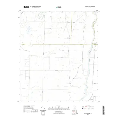
2020 Map of Steadhams Store
USGS Topo · Published 2020About this map
Steadhams Store serves as a central landmark in this rural landscape at the intersection of Newton Rd and Cooktown Rd. Situated along the eastern edge of Decatur County, the area is defined by the winding course of the Flint River, which forms the boundary with Mitchell and Baker counties. The terrain is crisscrossed by an extensive network of local roads named for prominent area families, including Casey Carter Rd, Whites Bridges Rd, and Robinson Wells Rd. To the south, Brock Airpark indicates the integration of small-scale aviation into this agricultural region. The map captures a detailed inventory of rural infrastructure, from numerous small ponds and depressions to the various routes like Riverbend Rd that track the river's floodplain. The density of named family roads suggests a long-settled community of landholders concentrated west of the river valley.
Find a feature on this map
41 named features on this map. Tap any name to fly to it.
Don’t see what you’re looking for? This feature index may not catch every label — zoom into the map to look around manually.
Map Details
Editions of this 2020 Steadhams Store Map
This is the sole edition of this map. No revisions or reprints were ever made.
Other maps of this area

1953 · Dothan
USGS Topo · 1:250,000

1954 · Dothan
USGS Topo · 1:250,000

1954 · Tallahassee
USGS Topo · 1:250,000

1955 · Dothan
USGS Topo · 1:250,000

1955 · Bainbridge
USGS Topo · 1:62,500

1955 · Whigham
USGS Topo · 1:62,500

1959 · Tallahassee
USGS Topo · 1:250,000

1960 · Tallahassee
USGS Topo · 1:250,000

1971 · Vada
USGS Topo · 1:24,000

1971 · Hopeful
USGS Topo · 1:24,000