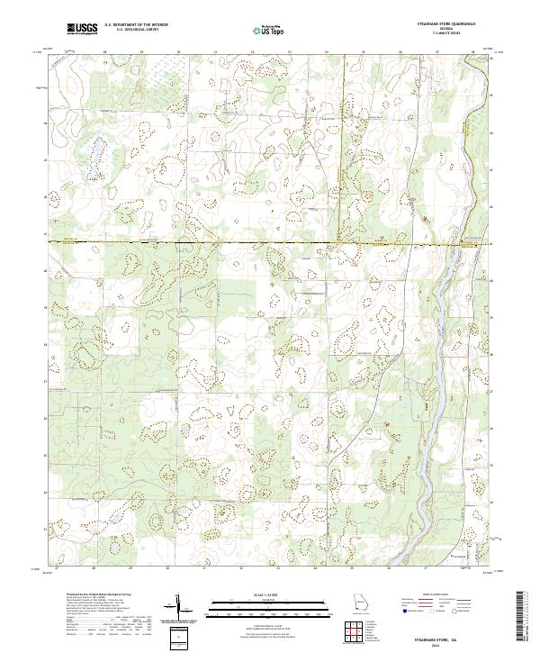
2024 Map of Steadhams Store
USGS Topo · Published 2024About this map
The Flint River forms a defining eastern boundary for this agricultural landscape where the borders of Miller, Baker, Mitchell, and Decatur counties converge. The terrain is characterized by a dense network of local roads and family-named landmarks that hint at the rural social fabric of the region. Distinctive routes like Pond Town Rd and Stoney Lonesome Rd traverse the patchwork of fields and woodlands, while Whites Bridges Rd marks the county line. This contemporary survey by the U.S. Geological Survey captures the persisting rural character of the area, punctuated by specialized features such as Brock Airpark in the southeast and legacy locations like Robinson Wells Rd. The presence of Old Airport Rd in the northwest suggests a history of aviation and transport that has shaped the local layout over decades.
Find a feature on this map
42 named features on this map. Tap any name to fly to it.
Don’t see what you’re looking for? This feature index may not catch every label — zoom into the map to look around manually.
Map Details
Editions of this 2024 Steadhams Store Map
This is the sole edition of this map. No revisions or reprints were ever made.
Other maps of this area

1953 · Dothan
USGS Topo · 1:250,000

1954 · Dothan
USGS Topo · 1:250,000

1954 · Tallahassee
USGS Topo · 1:250,000

1955 · Dothan
USGS Topo · 1:250,000

1955 · Bainbridge
USGS Topo · 1:62,500

1955 · Whigham
USGS Topo · 1:62,500

1959 · Tallahassee
USGS Topo · 1:250,000

1960 · Tallahassee
USGS Topo · 1:250,000

1971 · Vada
USGS Topo · 1:24,000

1971 · Hopeful
USGS Topo · 1:24,000