
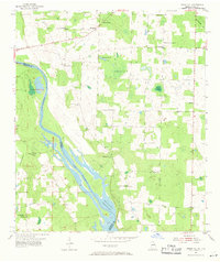
1954 Map of Steam Mill
USGS Topo · Published 1955About this map
Jim Woodruff Reservoir dominates the riverine landscape where the Chattahoochee River defines the border between Georgia and Florida. Surveyed in the early 1950s, this area reflects a rural community organized around small settlements like Riverturn and the namesake Steam Mill. The settlement pattern is characterized by numerous local institutions, including Macedonia Ch, St Marys Ch, and Trinity Ch, alongside family-named landmarks like Williams Cem and Brunson Cem.
Find a feature on this map
27 named features on this map. Tap any name to fly to it.
Don’t see what you’re looking for? This feature index may not catch every label — zoom into the map to look around manually.
Map Details
Editions of this 1954 Steam Mill Map
2 editions found
Other maps of this area

1952 · Dellwood
USGS Topo · 1:24,000

1952 · Bascom
USGS Topo · 1:24,000

1953 · Dothan
USGS Topo · 1:250,000

1954 · Dothan
USGS Topo · 1:250,000

1954 · Desser
USGS Topo · 1:24,000

1954 · Tallahassee
USGS Topo · 1:250,000

1955 · Dothan
USGS Topo · 1:250,000

1955 · Fairchild
USGS Topo · 1:24,000

1955 · Reynoldsville
USGS Topo · 1:24,000

1959 · Tallahassee
USGS Topo · 1:250,000