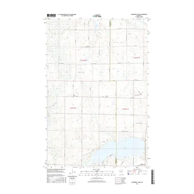
2016 Map of Steamboat Lake
USGS Topo · Published 2016About this map
The Necktie River flows through this wetland-heavy landscape in the mid-2010s, marking the transition between Hubbard and Cass counties. The area is characterized by numerous glacial water bodies, from the expansive Steamboat Lake in the south to smaller basins like Bowman Lake and Spike Lake further north. The small settlement of Wilkinson is situated near the southeastern shore of Steamboat Lake, where local history is anchored by the Green Lea Cem and Zion Memorial Cem. The transportation network is defined by a grid of county roads and residential lanes, such as Necktie River Rd and Tower Rd, which navigate the intricate system of creeks including Bungashing Cr. This map documents a period of established lakeside residence and rural cemetery sites within the Minnesota woods.
Find a feature on this map
52 named features on this map. Tap any name to fly to it.
Don’t see what you’re looking for? This feature index may not catch every label — zoom into the map to look around manually.
Map Details
Editions of this 2016 Steamboat Lake Map
This is the sole edition of this map. No revisions or reprints were ever made.
Other maps of this area

1954 · Bemidji
USGS Topo · 1:250,000

1957 · Bemidji
USGS Topo · 1:250,000

1958 · Bemidji
USGS Topo · 1:250,000

1968 · Guthrie
USGS Topo · 1:24,000

1968 · Bemidji East
USGS Topo · 1:24,000

1972 · Steamboat Bay
USGS Topo · 1:24,000

1972 · Benedict
USGS Topo · 1:24,000

1972 · Laporte
USGS Topo · 1:24,000

1972 · Pike Bay
USGS Topo · 1:24,000
1972 · Cass Lake
USGS Topo · 1:24,000