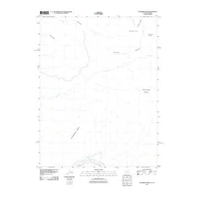
2011 Map of Steamboat Mesa
USGS Topo · Published 2011About this map
The Dolores River winds through the southern edge of this landscape, carving a path beneath the high elevation of Steamboat Mesa. The drainage patterns here are complex, with Granite Creek and Ryan Creek creating a network of deep channels across the high plateau country. Significant landforms like Piñon Mesa and Lost Horse Basin indicate a topography of distinct basins and overlooks, such as Renegade Point.
Find a feature on this map
14 named features on this map. Tap any name to fly to it.
Don’t see what you’re looking for? This feature index may not catch every label — zoom into the map to look around manually.
Map Details
Editions of this 2011 Steamboat Mesa Map
This is the sole edition of this map. No revisions or reprints were ever made.
Other maps of this area

1885 · La Sal
USGS Topo · 1:250,000

1949 · Gateway
USGS Topo · 1:24,000

1952 · Gateway
USGS Topo · 1:24,000

1954 · Mt. Waas 4 NE
USGS Topo · 1:24,000

1954 · Mt. Waas 4 NW
USGS Topo · 1:24,000

1954 · Mt. Waas 1 SW
USGS Topo · 1:24,000

1954 · Mt. Waas 1 NE
USGS Topo · 1:24,000

1954 · Mt. Waas 1 NW
USGS Topo · 1:24,000

1954 · Mt. Waas 1 SE
USGS Topo · 1:24,000

1954 · Coates Creek
USGS Topo · 1:62,500