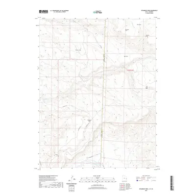
2020 Map of Steamboat Mesa
USGS Topo · Published 2020About this map
Steamboat Mesa dominates this western Colorado landscape where high-desert mesas meet the carved drainage of the Dolores River. Located along the boundary of Grand County, Utah, and Mesa County, Colorado, the area is defined by sharp elevation changes and named topographic landmarks such as Renegade Point and the Haystack Peaks. The map illustrates a complex network of canyons and draws, including Buckhorn Draw and Lost Horse Basin, which feed into seasonal and perennial watercourses like Granite Cr and Ryan Creek. Near the southern edge of the sheet, the river channel reaches Stateline Rapids, a significant point of interest for river navigation and geography. The absence of major settlements emphasizes the wilderness character of the Steamboat Area, while named features like Ryan Park suggest historical land use in this high-altitude terrain.
Find a feature on this map
18 named features on this map. Tap any name to fly to it.
Don’t see what you’re looking for? This feature index may not catch every label — zoom into the map to look around manually.
Map Details
Editions of this 2020 Steamboat Mesa Map
This is the sole edition of this map. No revisions or reprints were ever made.
Other maps of this area

1885 · La Sal
USGS Topo · 1:250,000

1949 · Gateway
USGS Topo · 1:24,000

1952 · Gateway
USGS Topo · 1:24,000

1954 · Mt. Waas 4 NE
USGS Topo · 1:24,000

1954 · Mt. Waas 4 NW
USGS Topo · 1:24,000

1954 · Mt. Waas 1 SW
USGS Topo · 1:24,000

1954 · Mt. Waas 1 NE
USGS Topo · 1:24,000

1954 · Mt. Waas 1 NW
USGS Topo · 1:24,000

1954 · Mt. Waas 1 SE
USGS Topo · 1:24,000

1954 · Coates Creek
USGS Topo · 1:62,500