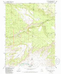
1985 Map of Steamboat Mesa
USGS Topo · Published 1986About this map
The Dolores River cuts through the southwestern corner of this high-desert plateau, marked by notable water features like Stateline Rapids and smaller Rapids along the canyon floor. This 1980s landscape is defined by the massive uplift of Steamboat Mesa and Piñon Mesa, which dominate the central and northern terrain. A network of drainage systems, including Granite Creek and Ryan Creek, has carved deep into the earth, creating isolated features such as Renegade Point and Buckhorn Draw. The map documents the border between Grand Co, Utah, and Mesa Co, Colorado, showing a region where the land's orientation is dictated by its verticality. From the high elevations of the Haystack Peaks to the sheltered Lost Horse Basin, the sheet illustrates a demanding environment primarily accessed via 4WD tracks and remote mountain trails.
Find a feature on this map
17 named features on this map. Tap any name to fly to it.
Don’t see what you’re looking for? This feature index may not catch every label — zoom into the map to look around manually.
Map Details
Editions of this 1985 Steamboat Mesa Map
This is the sole edition of this map. No revisions or reprints were ever made.
Other maps of this area

1885 · La Sal
USGS Topo · 1:250,000

1949 · Gateway
USGS Topo · 1:24,000

1952 · Gateway
USGS Topo · 1:24,000

1954 · Mt. Waas 4 NE
USGS Topo · 1:24,000

1954 · Mt. Waas 4 NW
USGS Topo · 1:24,000

1954 · Mt. Waas 1 SW
USGS Topo · 1:24,000

1954 · Mt. Waas 1 NE
USGS Topo · 1:24,000

1954 · Mt. Waas 1 NW
USGS Topo · 1:24,000

1954 · Mt. Waas 1 SE
USGS Topo · 1:24,000

1954 · Coates Creek
USGS Topo · 1:62,500