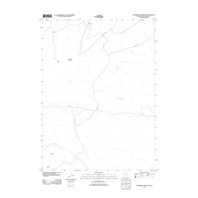
2012 Map of Steamboat Mountain
USGS Topo · Published 2012About this map
Chilton Ranch and Johnson Ranch anchor the northern landscape of this Sweetwater County high-desert terrain, where water sources are vital landmarks for navigation and land use. The presence of multiple springs, including Split Rock Spring, Pine Spring, and Iron Spring, indicates a reliance on scattered water points for ranching operations. The topography is defined by significant elevations such as Steamboat Mountain and the western descent through Sand Gap. Further south, the landscape is punctuated by Endlich Hill and Hague Hill, while Carson Lakes and the Brown Rock Reservoir represent the primary standing water features in this arid region. These features, along with routes like Freighter Gap Rd and Chilton Rd, trace the movement of livestock and supplies across a territory shaped by Bureau of Land Management oversight.
Find a feature on this map
19 named features on this map. Tap any name to fly to it.
Don’t see what you’re looking for? This feature index may not catch every label — zoom into the map to look around manually.
Map Details
Editions of this 2012 Steamboat Mountain Map
This is the sole edition of this map. No revisions or reprints were ever made.
Other maps of this area

1954 · Rock Springs
USGS Topo · 1:250,000

1955 · Lander
USGS Topo · 1:250,000

1958 · Lander
USGS Topo · 1:250,000

1958 · Rock Springs
USGS Topo · 1:250,000

1958 · Essex Mountain
USGS Topo · 1:62,500

1958 · Boars Tusk
USGS Topo · 1:62,500

1958 · Freighter Gap
USGS Topo · 1:62,500

1958 · Superior
USGS Topo · 1:62,500

1961 · Lander
USGS Topo · 1:250,000

1962 · Rock Springs
USGS Topo · 1:250,000