
1926 Map of Steamboat Mtn
USGS Topo · Published 1954About this map
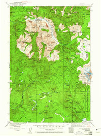
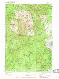
The Cispus River valley and the high peaks of the Gifford Pinchot National Forest define this 1920s topography. The map documents a landscape of mountain infrastructure, characterized by several remote forest outposts like the Tower Rock Ranger Sta and Berry Patch Ranger Sta. The prevalence of named camps, including Buckhorn Camp, Stabler Camp, and Sled Camp, suggests a region defined by seasonal work and early forest management before widespread modernization. To the east, the ice-clad slopes of Mount Adams are detailed, showing the Adams Glacier and White Salmon Glacier. High-altitude water bodies such as Takhlakh Pond and Olallie Lake sit among prominent summits like Sunrise Peak and McCoy Peak, while the Williams Mine indicates the era's small-scale resource extraction in the southern reaches near Grand Meadow.
Find a feature on this map
179 named features on this map. Tap any name to fly to it.
Don’t see what you’re looking for? This feature index may not catch every label — zoom into the map to look around manually.
Map Details
Editions of this 1926 Steamboat Mtn Map
3 editions found
Other maps of this area

1902 · Mount Aix
USGS Topo · 1:125,000

1904 · Mt Aix
USGS Topo · 1:125,000

1904 · Mount Adams
USGS Topo · 1:125,000

1907 · Mount Adams
USGS Topo · 1:125,000

1919 · Mount St Helens
USGS Topo · 1:125,000

1924 · Mt Rainier
USGS Topo · 1:96,000

1926 · Hood River
USGS Topo · 1:125,000

1928 · Mt Rainier
USGS Topo · 1:125,000

1929 · Hood River
USGS Topo · 1:125,000

1931 · Steamboat Mtn
USGS Topo · 1:125,000