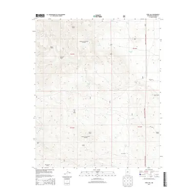
2013 Map of Steel Hill
USGS Topo · Published 2013About this map
Cibola National Forest encompasses this high-elevation landscape in Socorro County, where water sources dictate the placement of human activity. The map reveals a network of vital springs and tanks, including Pine Tree Spring, Rabbit Eye Spring, and Nogalito Spring, which sustain the area's ranching heritage. Local landmarks such as Steel Hill and Bell Hill rise above the drainage of Indian Cr, while the presence of the San Jose Cabin and Nogal Canyon Ranch points to a long-standing pattern of seasonal habitation and livestock management. Windmills, including Rincon Windmill and La Cabra Windmill, are scattered across the terrain, serving as modern indicators of the essential infrastructure required to survive in this arid environment. The map also traces significant topographic features like Cerra de las Cabras and the winding course of San Jose Arroyo.
Find a feature on this map
33 named features on this map. Tap any name to fly to it.
Don’t see what you’re looking for? This feature index may not catch every label — zoom into the map to look around manually.
Map Details
Editions of this 2013 Steel Hill Map
This is the sole edition of this map. No revisions or reprints were ever made.
Other maps of this area

1954 · Tularosa
USGS Topo · 1:250,000

1958 · Tularosa
USGS Topo · 1:250,000

1961 · Sierra Fijardo
USGS Topo · 1:24,000

1961 · Hickman Ranch
USGS Topo · 1:24,000

1961 · Black Hill
USGS Topo · 1:24,000

1961 · Monticello
USGS Topo · 1:24,000

1961 · Romero Canyon
USGS Topo · 1:24,000

1964 · Vicks Peak
USGS Topo · 1:24,000

1964 · San Juan Peak
USGS Topo · 1:24,000

1964 · Blue Mountain
USGS Topo · 1:24,000