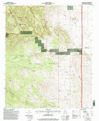
1995 Map of Steel Hill
USGS Topo · Published 1998About this map
Apache Kid Wilderness dominates the western portion of this high-altitude landscape, where deep drainages like Springtime Canyon and Roberts Canyon carve through the rugged interior of the Cibola National Forest. The map documents a sparse, resource-driven settlement pattern characterized by isolated ranching infrastructure and mineral exploration, notably the Panky Mine and the Nogal Canyon Ranch. Evidence of water management in this arid terrain is ubiquitous, with numerous catchment points such as Humpback Tank, Silverado Spring, and the Cuervo Windmill supporting local livestock and land use. Geologic landmarks such as Steel Hill and the prominent Cerra de las Cabras define the horizon, while the First Guide Meridian West Auxiliary provides a clear surveying benchmark across the eastern plateau.
Find a feature on this map
32 named features on this map. Tap any name to fly to it.
Don’t see what you’re looking for? This feature index may not catch every label — zoom into the map to look around manually.
Map Details
Editions of this 1995 Steel Hill Map
This is the sole edition of this map. No revisions or reprints were ever made.
Other maps of this area

1954 · Tularosa
USGS Topo · 1:250,000

1958 · Tularosa
USGS Topo · 1:250,000

1961 · Sierra Fijardo
USGS Topo · 1:24,000

1961 · Hickman Ranch
USGS Topo · 1:24,000

1961 · Black Hill
USGS Topo · 1:24,000

1961 · Monticello
USGS Topo · 1:24,000

1961 · Romero Canyon
USGS Topo · 1:24,000

1964 · Vicks Peak
USGS Topo · 1:24,000

1964 · San Juan Peak
USGS Topo · 1:24,000

1964 · Blue Mountain
USGS Topo · 1:24,000