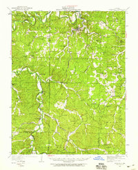
1949 Map of Steelville
USGS Topo · Published 1959About this map
Steelville serves as the central hub of this Missouri Ozarks landscape, where the Meramec River and Whittenberg Creek dictate the local geography. The map reveals a transition in transportation history, documenting the St Louis San Francisco railroad alongside a notable southern section marked as St Louis San Francisco (Abandoned) near Sligo. This area, once a center for iron production, is shown here as a network of rural school districts and small communities.
Find a feature on this map
68 named features on this map. Tap any name to fly to it.
Don’t see what you’re looking for? This feature index may not catch every label — zoom into the map to look around manually.
Map Details
Editions of this 1949 Steelville Map
This is the sole edition of this map. No revisions or reprints were ever made.
Other maps of this area

1903 · Sullivan
USGS Topo · 1:125,000

1928 · Meramec Spring
USGS Topo · 1:62,500

1932 · Steelville
USGS Topo · 1:48,000

1933 · Steelville
USGS Topo · 1:62,500

1934 · Redbird
USGS Topo · 1:62,500

1937 · Steelville
USGS Topo · 1:62,500

1938 · Redbird
USGS Topo · 1:62,500

1941 · Salem
USGS Topo · 1:62,500

1941 · Stone Hill
USGS Topo · 1:62,500

1943 · Berryman
USGS Topo · 1:62,500