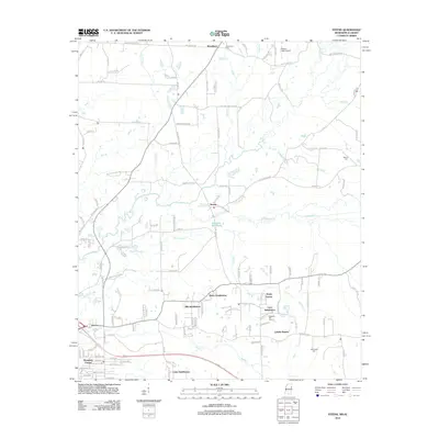
2012 Map of Steens
USGS Topo · Published 2012About this map
Luxapallila Cr and its meandering tributaries dominate this 2012 survey of the Alabama-Mississippi borderlands, where the landscape is defined by the wetlands of Bonny Slough and Jamisons Mill Pond. The community of Steens sits centrally, surrounded by modern residential growth including Melco Subdivision, Ellis Subdivision, and Remunda Estates. This mix of established rural settlements and newer developments highlights the suburban transition of the Columbus area during the early 21st century.
Find a feature on this map
123 named features on this map. Tap any name to fly to it.
Don’t see what you’re looking for? This feature index may not catch every label — zoom into the map to look around manually.
Map Details
Editions of this 2012 Steens Map
This is the sole edition of this map. No revisions or reprints were ever made.
Other maps of this area

1953 · West Point
USGS Topo · 1:250,000

1958 · West Point
USGS Topo · 1:250,000

1960 · Caledonia
USGS Topo · 1:62,500

1960 · Columbus
USGS Topo · 1:62,500

1963 · West Point
USGS Topo · 1:250,000

1966 · Ethelsville
USGS Topo · 1:24,000

1967 · Millport NW
USGS Topo · 1:24,000

1967 · Fernbank
USGS Topo · 1:24,000

1982 · West Point
USGS Topo · 1:100,000

1984 · West Point
USGS Topo · 1:250,000