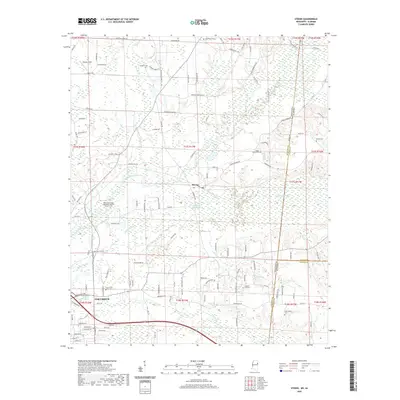
2020 Map of Steens
USGS Topo · Published 2020About this map
The community of Steens sits at the heart of this landscape, where the waters of Luxapalila Creek and Yellow Creek converge near the border of Lowndes County, Mississippi and Lamar County, Alabama. The area's history is deeply rooted in its local cemeteries and religious sites, such as the New Zions Steens Missionary Baptist Church Cem and Military Chapel. To the southwest, the outskirts of Columbus begin to appear, bounded by the Tuscaloosa Rd and residential developments around Pierce Rd. The map reveals a rural economy shaped by hydrology, notably at Jamisons Mill Pond and along the various sloughs like Bonny Slough. Numerous family-named landmarks, from Vaughn's Cem to Shockly Field, offer clear points of interest for those tracing the development of the region's homesteads and local infrastructure.
Find a feature on this map
128 named features on this map. Tap any name to fly to it.
Don’t see what you’re looking for? This feature index may not catch every label — zoom into the map to look around manually.
Map Details
Editions of this 2020 Steens Map
This is the sole edition of this map. No revisions or reprints were ever made.
Other maps of this area

1953 · West Point
USGS Topo · 1:250,000

1958 · West Point
USGS Topo · 1:250,000

1960 · Caledonia
USGS Topo · 1:62,500

1960 · Columbus
USGS Topo · 1:62,500

1963 · West Point
USGS Topo · 1:250,000

1966 · Ethelsville
USGS Topo · 1:24,000

1967 · Millport NW
USGS Topo · 1:24,000

1967 · Fernbank
USGS Topo · 1:24,000

1982 · West Point
USGS Topo · 1:100,000

1984 · West Point
USGS Topo · 1:250,000