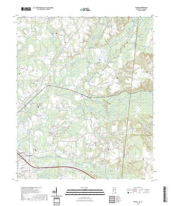
2024 Map of Steens
USGS Topo · Published 2024About this map
The community of Steens serves as the focal point of this Mississippi landscape, situated just northeast of the edge of Columbus. The terrain is defined by an intricate network of waterways, most notably the meandering Luxapallila Creek which is joined by numerous tributaries including Yellow Creek, Brush Creek, and Magby Creek. This 2024 survey documents a region where the rural heritage is preserved through a high concentration of historic burial grounds and family-named landmarks.
Find a feature on this map
133 named features on this map. Tap any name to fly to it.
Don’t see what you’re looking for? This feature index may not catch every label — zoom into the map to look around manually.
Map Details
Editions of this 2024 Steens Map
This is the sole edition of this map. No revisions or reprints were ever made.
Other maps of this area

1953 · West Point
USGS Topo · 1:250,000

1958 · West Point
USGS Topo · 1:250,000

1960 · Caledonia
USGS Topo · 1:62,500

1960 · Columbus
USGS Topo · 1:62,500

1963 · West Point
USGS Topo · 1:250,000

1966 · Ethelsville
USGS Topo · 1:24,000

1967 · Millport NW
USGS Topo · 1:24,000

1967 · Fernbank
USGS Topo · 1:24,000

1982 · West Point
USGS Topo · 1:100,000

1984 · West Point
USGS Topo · 1:250,000