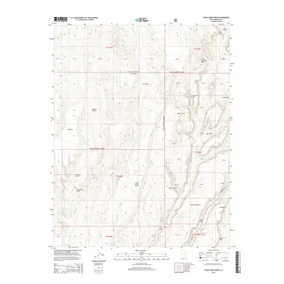
2014 Map of Steep Creek Bench
USGS Topo · Published 2014About this map
The Dixie National Forest covers much of this high-plateau terrain, characterized by a series of dramatic geographic benches and deep-cut canyons. The central Steep Creek Bench is flanked by several prominent drainages, including Steep Cr and Frisky Cr, while the southeastern corner is defined by the Circle Cliffs and King Bench. This landscape is marked by unique geologic formations such as Lamanite Arch and the appropriately named Impossible Peak in the northeast. Transportation through this remote stretch of Garfield County is limited primarily to the winding path of Burr Trail Rd, which snakes across the southern portion of the quadrangle. The map reveals the intricate drainage patterns of Slickrock Canyon and Cottonwood Canyon, providing a clear record of the area's hydrology and land partitions before more recent environmental changes.
Find a feature on this map
45 named features on this map. Tap any name to fly to it.
Don’t see what you’re looking for? This feature index may not catch every label — zoom into the map to look around manually.
Map Details
Editions of this 2014 Steep Creek Bench Map
This is the sole edition of this map. No revisions or reprints were ever made.
Other maps of this area

1885 · Fish Lake
USGS Topo · 1:250,000

1886 · Escalante
USGS Topo · 1:250,000

1896 · Fish Lake
USGS Topo · 1:250,000

1952 · Notom 3 SW
USGS Topo · 1:24,000

1952 · Notom 4 SW
USGS Topo · 1:24,000

1952 · Notom 3 SE
USGS Topo · 1:24,000

1952 · Grover
USGS Topo · 1:62,500

1952 · Notom
USGS Topo · 1:62,500

1953 · Circle Cliffs 2 NE
USGS Topo · 1:24,000

1953 · Circle Cliffs 1 SW
USGS Topo · 1:24,000