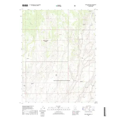
2020 Map of Steep Creek Bench
USGS Topo · Published 2020About this map
Dixie National Forest and the Grand Staircase-Escalante National Monument meet in this high-desert landscape, dominated by intricate canyon systems and uplifted benches. The terrain is defined by dramatic elevation changes, notably at Impossible Peak and along the eastern edge where Circle Cliffs descend into deep drainages. Significant landmarks like Lamanite Arch and The Gulch highlight the area's geological character, while water sources such as Steep Cr and Deer Cr carve through the sandstone.
Find a feature on this map
24 named features on this map. Tap any name to fly to it.
Don’t see what you’re looking for? This feature index may not catch every label — zoom into the map to look around manually.
Map Details
Editions of this 2020 Steep Creek Bench Map
This is the sole edition of this map. No revisions or reprints were ever made.
Other maps of this area

1885 · Fish Lake
USGS Topo · 1:250,000

1886 · Escalante
USGS Topo · 1:250,000

1896 · Fish Lake
USGS Topo · 1:250,000

1952 · Notom 3 SW
USGS Topo · 1:24,000

1952 · Notom 4 SW
USGS Topo · 1:24,000

1952 · Notom 3 SE
USGS Topo · 1:24,000

1952 · Grover
USGS Topo · 1:62,500

1952 · Notom
USGS Topo · 1:62,500

1953 · Circle Cliffs 2 NE
USGS Topo · 1:24,000

1953 · Circle Cliffs 1 SW
USGS Topo · 1:24,000