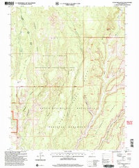
2002 Map of Steep Creek Bench
USGS Topo · Published 2005About this map
Grand Staircase-Escalante National Monument and the Dixie National Forest meet in this 2002 revision of the Garfield County landscape. The mapping reflects the complex management of public lands, delineating the Loa - Teasdale Ranger District and the Escalante Ranger District. A lone human structure, the Long Neck Cabin, stands near the ridge of Long Neck, overlooking a series of deep drainages including Cottonwood Canyon and Slickrock Canyon.
Find a feature on this map
42 named features on this map. Tap any name to fly to it.
Don’t see what you’re looking for? This feature index may not catch every label — zoom into the map to look around manually.
Map Details
Editions of this 2002 Steep Creek Bench Map
This is the sole edition of this map. No revisions or reprints were ever made.
Other maps of this area

1885 · Fish Lake
USGS Topo · 1:250,000

1886 · Escalante
USGS Topo · 1:250,000

1896 · Fish Lake
USGS Topo · 1:250,000

1952 · Notom 3 SW
USGS Topo · 1:24,000

1952 · Notom 4 SW
USGS Topo · 1:24,000

1952 · Notom 3 SE
USGS Topo · 1:24,000

1952 · Grover
USGS Topo · 1:62,500

1952 · Notom
USGS Topo · 1:62,500

1953 · Circle Cliffs 2 NE
USGS Topo · 1:24,000

1953 · Circle Cliffs 1 SW
USGS Topo · 1:24,000