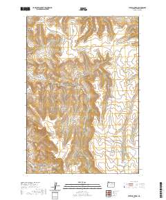
2020 Map of Steet Mountain
USGS Topo · Published 2020About this map
Schoolhouse Hill rises prominently in the southern reaches of this Grant County landscape, accompanied by the vital Schoolhouse Hill Spring near the banks of the S Fork Cottonwood Cr. The terrain is defined by a dense network of drainages and named canyons, suggesting a history of local land use tied to these specific geographic markers. In the northwest, Steet Mtn anchors the high ground above Steet Canyon and Briley Canyon.
Find a feature on this map
27 named features on this map. Tap any name to fly to it.
Don’t see what you’re looking for? This feature index may not catch every label — zoom into the map to look around manually.
Map Details
Editions of this 2020 Steet Mountain Map
This is the sole edition of this map. No revisions or reprints were ever made.
Other maps of this area

1949 · Long Creek
USGS Topo · 1:62,500

1950 · Ritter
USGS Topo · 1:62,500

1951 · Long Creek
USGS Topo · 1:62,500

1951 · Courtrock
USGS Topo · 1:62,500

1951 · Monument
USGS Topo · 1:62,500

1952 · Ritter
USGS Topo · 1:62,500

1955 · Canyon City
USGS Topo · 1:250,000

1959 · Canyon City
USGS Topo · 1:250,000

1980 · Monument
USGS Topo · 1:100,000
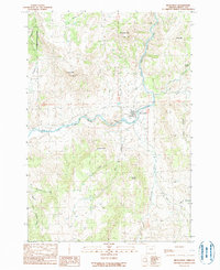
1990 · Monument
USGS Topo · 1:24,000