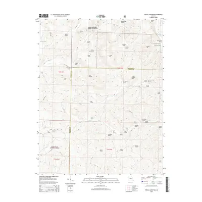
2015 Map of Stegall Mountain
USGS Topo · Published 2015About this map
Stegall Mountain stands as a prominent high point in this 2015 survey of the Missouri Ozarks, marking a landscape defined by deep drainages and isolated peaks. Much of the northern terrain is managed under the Ozark National Scenic Riverways, where the Current River cuts through the northeast corner. The southern portion of the map transitions into the Mark Twain National Forest, illustrating a heavily forested region where human settlement is sparse and concentrated along rural routes like Mo-NN and Peck Ranch Rd.
Find a feature on this map
71 named features on this map. Tap any name to fly to it.
Don’t see what you’re looking for? This feature index may not catch every label — zoom into the map to look around manually.
Map Details
Editions of this 2015 Stegall Mountain Map
This is the sole edition of this map. No revisions or reprints were ever made.
Other maps of this area

1915 · Eminence
USGS Topo · 1:62,500

1917 · Eminence
USGS Topo · 1:62,500

1928 · Cardareva
USGS Topo · 1:62,500

1931 · Bandyville
USGS Topo · 1:48,000

1944 · Van Buren
USGS Topo · 1:62,500

1944 · Birch Tree
USGS Topo · 1:62,500

1946 · Van Buren
USGS Topo · 1:62,500

1948 · Birch Tree
USGS Topo · 1:62,500

1949 · Rolla
USGS Topo · 1:250,000

1949 · Cardareva
USGS Topo · 1:62,500