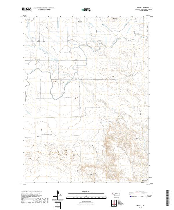
2021 Map of Stegall
USGS Topo · Published 2021About this map
Wildcat Hills dominate the southern portion of this landscape, where a series of deep drainages including Bobcat Canyon, Andys Canyon, and Cottonwood Canyon carve through the elevated terrain. These natural features contrast sharply with the northern section of the map, which is defined by an extensive human-engineered irrigation network. The presence of the Fort Laramie Canal and complex water management systems like Kiowa Diversion Lateral Number 1 and the Lowery Reservoir highlight the region's reliance on managed water for agriculture. Near the small settlement of Stegall, numerous man-made drains such as McCreary Drain and Butcher Drain crisscross the valley floor. To the east, prominent landmarks like Bald Peak and Signal Butte rise above the surrounding plains, while Roubadeau Pass Rd follows the historical contours of the land, providing a link between the rugged southern canyons and the irrigated farmland to the north.
Find a feature on this map
40 named features on this map. Tap any name to fly to it.
Don’t see what you’re looking for? This feature index may not catch every label — zoom into the map to look around manually.
Map Details
Editions of this 2021 Stegall Map
This is the sole edition of this map. No revisions or reprints were ever made.
Other maps of this area

1898 · Scotts Bluff
USGS Topo · 1:125,000

1899 · Goshen Hole
USGS Topo · 1:125,000

1954 · Scottsbluff
USGS Topo · 1:250,000

1954 · Cheyenne
USGS Topo · 1:250,000

1958 · Cheyenne
USGS Topo · 1:250,000

1958 · Scottsbluff
USGS Topo · 1:250,000

1960 · Mc Compsey Pass
USGS Topo · 1:24,000

1960 · Lyman
USGS Topo · 1:24,000

1960 · Stegall
USGS Topo · 1:24,000

1960 · Murray Lake
USGS Topo · 1:24,000