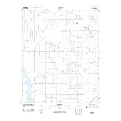
2009 Map of Stella
USGS Topo · Published 2009About this map
Stella Cemetery and the surrounding rural residential development define this corner of Oklahoma City in the early 21st century. The landscape is structured by a strict section-line grid of roads, including E Franklin Rd and Patterson Dr, which navigate a terrain carved by several significant waterways. To the west, the broad valley of Hog Creek dominates the lowlands, while Willow Branch and Pecan Creek branch out across the central and southern reaches.
Find a feature on this map
71 named features on this map. Tap any name to fly to it.
Don’t see what you’re looking for? This feature index may not catch every label — zoom into the map to look around manually.
Map Details
Editions of this 2009 Stella Map
This is the sole edition of this map. No revisions or reprints were ever made.
Other maps of this area

1892 · Moore
USGS Topo · 1:62,500

1893 · Norman
USGS Topo · 1:62,500

1898 · Purcell
USGS Topo · 1:125,000

1910 · McComb
USGS Topo · 1:62,500

1930 · McLoud
USGS Topo · 1:62,500

1934 · Moore
USGS Topo · 1:62,500

1936 · Norman
USGS Topo · 1:62,500

1938 · Moore
USGS Topo · 1:62,500

1954 · Oklahoma City
USGS Topo · 1:250,000
1956 · Choctaw
USGS Topo · 1:24,000