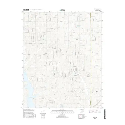
2016 Map of Stella
USGS Topo · Published 2016About this map
Stella serves as a central landmark in this portion of central Oklahoma, situated along the border of Cleveland and Pottawatomie counties. The landscape is defined by the headwaters and drainages of several creeks, including Pecan Creek, South Deer Creek, and Hog Creek. Significant water features like the eastern reaches of Lake Thunderbird and the Upper Black Bear Creek Site 10 Reservoir demonstrate the region's mid-century water management and recreation infrastructure.
Find a feature on this map
75 named features on this map. Tap any name to fly to it.
Don’t see what you’re looking for? This feature index may not catch every label — zoom into the map to look around manually.
Map Details
Editions of this 2016 Stella Map
This is the sole edition of this map. No revisions or reprints were ever made.
Other maps of this area

1892 · Moore
USGS Topo · 1:62,500

1893 · Norman
USGS Topo · 1:62,500

1898 · Purcell
USGS Topo · 1:125,000

1910 · McComb
USGS Topo · 1:62,500

1930 · McLoud
USGS Topo · 1:62,500

1934 · Moore
USGS Topo · 1:62,500

1936 · Norman
USGS Topo · 1:62,500

1938 · Moore
USGS Topo · 1:62,500

1954 · Oklahoma City
USGS Topo · 1:250,000
1956 · Choctaw
USGS Topo · 1:24,000