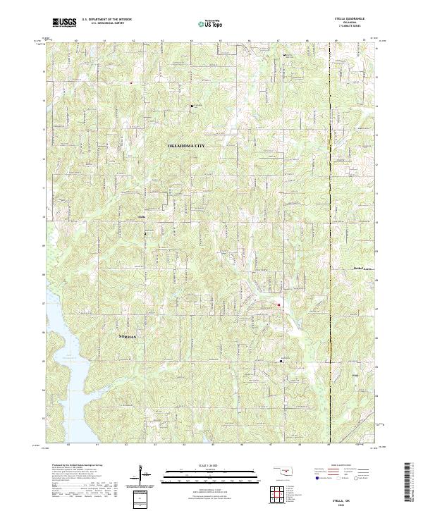
2022 Map of Stella
USGS Topo · Published 2022About this map
Stella serves as a central landmark in this 2022 survey of the rural landscape where eastern Oklahoma City and Norman meet the Cleveland Co Pottawatomie Co line. The terrain is defined by the winding drainages of Hog Cr and Willow Br, which flow toward the expansive Lake Thunderbird in the southwest corner. The map documents a dense network of sectional roads and rural residential development, including the communities of Bethel Acres and Pink. For genealogists and local historians, several small burial grounds are meticulously preserved, including Stella Cem, Friendship Cem, Knoles Cem, and Pilgrims Rest Cem. These sites, along with named water features like Pecan Cr and S Deer Cr, provide a contemporary look at a landscape transitioning from traditional agriculture to low-density suburban holdings near the state's largest urban centers.
Find a feature on this map
50 named features on this map. Tap any name to fly to it.
Don’t see what you’re looking for? This feature index may not catch every label — zoom into the map to look around manually.
Map Details
Editions of this 2022 Stella Map
This is the sole edition of this map. No revisions or reprints were ever made.
Other maps of this area

1892 · Moore
USGS Topo · 1:62,500

1893 · Norman
USGS Topo · 1:62,500

1898 · Purcell
USGS Topo · 1:125,000

1910 · McComb
USGS Topo · 1:62,500

1930 · McLoud
USGS Topo · 1:62,500

1934 · Moore
USGS Topo · 1:62,500

1936 · Norman
USGS Topo · 1:62,500

1938 · Moore
USGS Topo · 1:62,500

1954 · Oklahoma City
USGS Topo · 1:250,000
1956 · Choctaw
USGS Topo · 1:24,000