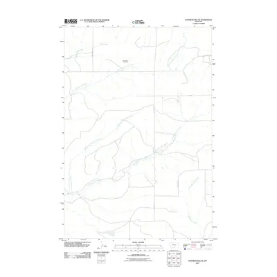
2011 Map of Stephens Hill NE
USGS Topo · Published 2011About this map
Dry Fork Sweet Grass Creek, Middle Fork Sweet Grass Creek, and the East Fork Sweet Grass Creek converge within this high-plains landscape in Sweet Grass County. This portion of Montana is defined by its drainage network, where the Dry Yellow Grass Dam regulates local waters. The map details a remote ranching infrastructure through its road system, featuring Stephens Hill Rd, Union Hall Rd, and Bays Rd. These routes provide access to the drainages of West White Beaver Creek and Whitney Creek, while the northern reaches are marked by the courses of Wildcat Creek and South Fork Big Coulee Creek. The distribution of these water sources and secondary roads reflects the enduring agrarian and ranching patterns of the region.
Find a feature on this map
13 named features on this map. Tap any name to fly to it.
Don’t see what you’re looking for? This feature index may not catch every label — zoom into the map to look around manually.
Map Details
Editions of this 2011 Stephens Hill NE Map
This is the sole edition of this map. No revisions or reprints were ever made.
Other maps of this area

1889 · Big Snowy Mountain
USGS Topo · 1:250,000

1891 · Big Timber
USGS Topo · 1:125,000

1892 · Stillwater
USGS Topo · 1:125,000

1893 · Big Snowy Mountain
USGS Topo · 1:250,000

1893 · Big Timber
USGS Topo · 1:125,000

1954 · Billings
USGS Topo · 1:250,000

1954 · Roundup
USGS Topo · 1:250,000

1955 · Antelope Point
USGS Topo · 1:24,000

1955 · Russell Gulch
USGS Topo · 1:24,000

1955 · Stephens Hill
USGS Topo · 1:24,000