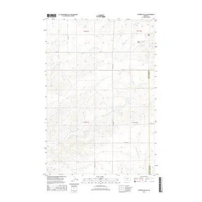
2017 Map of Stephens Hill NE
USGS Topo · Published 2017About this map
The rolling tablelands and drainage systems of Sweet Grass County define this landscape, where the West Bench rises above a complex network of intermittent streams and coulees. Tributaries of the Sweet Grass Creek system, including the E Fork Sweet Grass Cr, Middle Fork Sweet Grass Cr, and Dry Fork Sweet Grass Cr, carve a intricate pattern across the rangeland. This area, shared with the Stillwater County line to the east, reflects a classic Big Sky ranching environment where section lines and local roads like Rapelje Rd and Stephens Hill Rd provide the primary infrastructure. Small landforms such as Hoppy Gulch and watercourses like W White Beaver Cr offer specific markers for those tracing property boundaries or historical land use in this sparsely settled portion of Montana.
Find a feature on this map
20 named features on this map. Tap any name to fly to it.
Don’t see what you’re looking for? This feature index may not catch every label — zoom into the map to look around manually.
Map Details
Editions of this 2017 Stephens Hill NE Map
This is the sole edition of this map. No revisions or reprints were ever made.
Other maps of this area

1889 · Big Snowy Mountain
USGS Topo · 1:250,000

1891 · Big Timber
USGS Topo · 1:125,000

1892 · Stillwater
USGS Topo · 1:125,000

1893 · Big Snowy Mountain
USGS Topo · 1:250,000

1893 · Big Timber
USGS Topo · 1:125,000

1954 · Billings
USGS Topo · 1:250,000

1954 · Roundup
USGS Topo · 1:250,000

1955 · Antelope Point
USGS Topo · 1:24,000

1955 · Russell Gulch
USGS Topo · 1:24,000

1955 · Stephens Hill
USGS Topo · 1:24,000