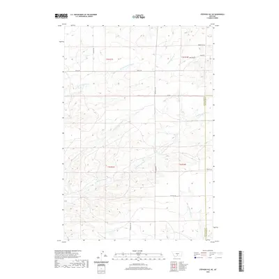
2020 Map of Stephens Hill NE
USGS Topo · Published 2020About this map
Dry Fork Sweet Grass Cr, Middle Fork Sweet Grass Cr, and E Fork Sweet Grass Cr carve a complex drainage pattern across this high-plains landscape in Sweet Grass and Stillwater counties. This modern topographic study reveals a terrain defined by long-established ranch roads and seasonal watercourses, where the boundary between T3N and T2N meets the county line. Significant local routes like Rapelje Rd and S Shawmut Rd link the northern reaches, while the southern portion is oriented around Union Hall Rd and the headwaters of W White Beaver Cr. The map highlights the intersection of topographic relief and cadastral history, showing how early township and range divisions like t3n r17e and t2n r18e overlay the natural geography of Hoppy Gulch and Whitney Cr.
Find a feature on this map
19 named features on this map. Tap any name to fly to it.
Don’t see what you’re looking for? This feature index may not catch every label — zoom into the map to look around manually.
Map Details
Editions of this 2020 Stephens Hill NE Map
This is the sole edition of this map. No revisions or reprints were ever made.
Other maps of this area

1889 · Big Snowy Mountain
USGS Topo · 1:250,000

1891 · Big Timber
USGS Topo · 1:125,000

1892 · Stillwater
USGS Topo · 1:125,000

1893 · Big Snowy Mountain
USGS Topo · 1:250,000

1893 · Big Timber
USGS Topo · 1:125,000

1954 · Billings
USGS Topo · 1:250,000

1954 · Roundup
USGS Topo · 1:250,000

1955 · Antelope Point
USGS Topo · 1:24,000

1955 · Russell Gulch
USGS Topo · 1:24,000

1955 · Stephens Hill
USGS Topo · 1:24,000