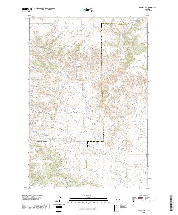
2024 Map of Stephens Hill
USGS Topo · Published 2024About this map
Stephens Hill rises as a central landmark in this high-plains landscape, situated along the county line between Sweet Grass and Stillwater counties. The area is defined by a network of drainage systems, including the headwaters of West White Beaver Creek and the eastern flow of Spring Creek. Modern land use is reflected in the sparse but specific road network, which includes Stephens Hill Rd and the evocative Dry-Hole Trl, suggesting a history of resource exploration or agricultural persistence. The topography is deeply incised by features such as Wullum Gulch and the rugged passage of Deadmans Canyon Rd. These named roads and geographic markers provide a clear look at the contemporary Montana rangeland, where legacy property boundaries and township lines intersect with the natural contours of the Big Sky country.
Find a feature on this map
20 named features on this map. Tap any name to fly to it.
Don’t see what you’re looking for? This feature index may not catch every label — zoom into the map to look around manually.
Map Details
Editions of this 2024 Stephens Hill Map
This is the sole edition of this map. No revisions or reprints were ever made.
Other maps of this area

1891 · Big Timber
USGS Topo · 1:125,000

1892 · Stillwater
USGS Topo · 1:125,000

1893 · Big Timber
USGS Topo · 1:125,000

1954 · Billings
USGS Topo · 1:250,000

1955 · Antelope Point
USGS Topo · 1:24,000

1955 · Reed Point
USGS Topo · 1:24,000

1955 · Springtime
USGS Topo · 1:24,000

1955 · Russell Gulch
USGS Topo · 1:24,000

1955 · Stephens Hill
USGS Topo · 1:24,000
1956 · Work Creek
USGS Topo · 1:24,000